
Geoprognosis Tool
Using advanced tech to submerge your subsurface data in automation

Smart GeoPrognosis takes the most advanced tools, submerges your data in automation, and then adds brains to it. Now you have a geological prognosis tool that is aware of the ever-changing subsurface tapestry.
The GeoNotebook framework already includes world-class collaboration capabilities and GeoAnalytics, giving your team a speed advantage when working with thousands of wells and dozens of scenarios. Smart GeoPrognosis adds to the richness of your modeling capability and improves your team’s ability to communicate between regulatory, subsurface, drilling, and management.
Taming the data beast
Well and formation tops data is dramatically large and grows exponentially every day. One factor triggering this exponential growth rate is data duplication. GeoNotebook’s seamless collaboration eliminates the need for data multiplication given its native framework.
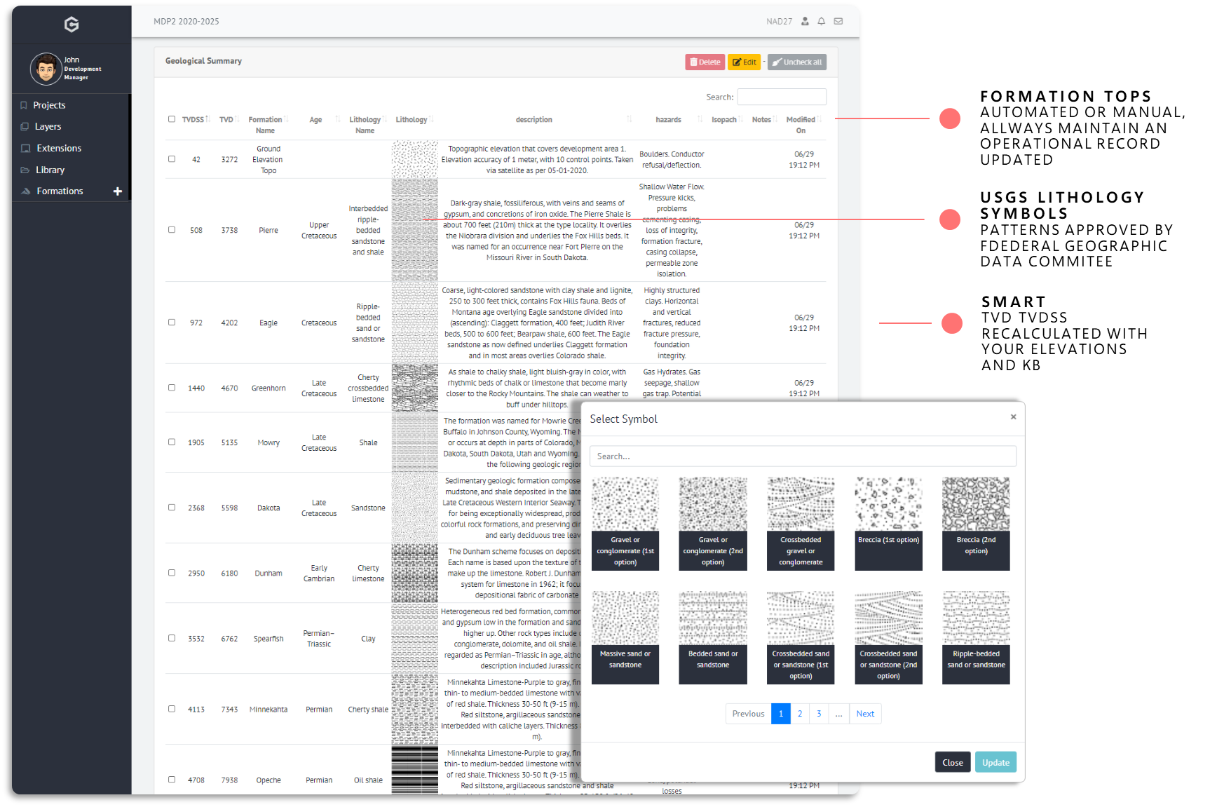
Formations Library
A formation tops library gives you access to uploads and keeps subsurface datasets organized and accessible.
Maintain a record of subsurface hazards, formation description, and technical constraints.
Your data follows you. Tagging data into projects filters out irrelevant formations. GeoNotebook filters all data knowing where you are in the home map. The brains behind the system always understand your data and guide you through the analysis.
Execute and Automate
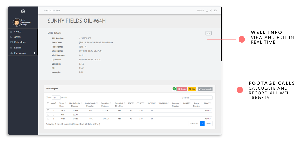
Wells, formation tops, and section lines are key ingredients to build your geological prognosis report. We focus on catching changes across your data and keeping your reports fresh and up to date so you can focus on understanding the subsurface world.
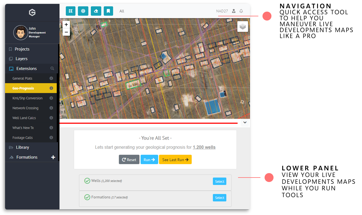

It's smart, but flexible, but smart. Smart enough to take mountains of work off of your shoulders without sacrificing the way you like to do your work. Reports are attached to your wells and ready for your team to contribute, share, and make decisions quickly.
Stay tuned for more!
We are working to bring more GeoNotebook features onboard to help you analyze and collaborate better with your team, create output for clients, and more. Meanwhile, you can give our conversion tool a shot and let us know your take.
If you want to recommend a new tool for integration then do let us know. For any questions or suggestions, you can drop us an email here. Enjoy!
1 Comment


Wowee Jose, this Geoprog extension is the macaracachimba!
Chance Sanger
2 days agoThanks Chance!
Jose Marrero
1 day ago